
NASA’s Terra satellite found two small areas of strength in Tropical Storm Nari on July 26 as it began to affect Japan.
NASA’s Terra satellite found two small areas of strength in Tropical Storm Nari on July 26 as it began to affect Japan.
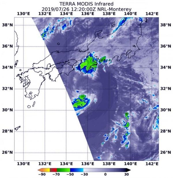
NASA’s Terra satellite uses infrared light to analyze the strength of storms by providing temperature information about the system’s clouds. The strongest thunderstorms that reach high into the atmosphere have the coldest cloud top temperatures.
On July 26 at 8:20 a.m. EDT (1220 UTC), the Moderate Imaging Spectroradiometer or MODIS instrument that flies aboard NASA’s Terra satellite gathered infrared data on Nari, formerly known as Tropical Storm 07W. There were two areas of strongest storms in Tropical Storm Nari, and they were north and south of the center of circulation. In those areas, thunderstorms had cloud top temperatures as cold as minus 50 degrees Fahrenheit (minus 45.5 Celsius). That northernmost area of strong storms was located over the Kyoto, Osaka and Wakayama Prefectures of Japan.
Read more at NASA/Goddard Space Flight Center
Image: On July 26 at 8:20 a.m. EDT (1220 UTC), the MODIS instrument that flies aboard NASA's Terra satellite showed two areas of strongest storms (yellow) in Tropical Storm Nari north and south of center. Cloud top temperatures in those areas were as cold as minus 50 degrees Fahrenheit (minus 45.5 Celsius). (Credit: NASA/NRL)


