
A University of Oklahoma-led study generated improved annual maps of tropical forest cover in the Brazilian Amazon in 2000-2017 and provided better characterization on the spatio-temporal dynamics of forest area, loss and gain in this region.
A University of Oklahoma-led study generated improved annual maps of tropical forest cover in the Brazilian Amazon in 2000-2017 and provided better characterization on the spatio-temporal dynamics of forest area, loss and gain in this region. The Amazon basin has the largest tropical forests in the world. Rapid changes in land use, climate and other human activities have resulted in substantial deforestation in the Brazilian Amazon over the past several decades.
“Monitoring, verification and reporting of tropical forest dynamics in the Brazilian Amazon have been a critical but challenging task for the research community and society-at-large. Available maps of tropical forest cover in the region have large uncertainty. In 2015, we assembled an international team from the United States, Brazil and China to tackle the challenging problem,” said Xiangming Xiao, George Lynn Cross Research Professor, Department of Microbiology and Plant Biology, OU College of Arts and Sciences.
“The international team used both optical and microwave images acquired by satellite-based sensors and advanced algorithms to improve annual maps of tropical forests in the Brazilian Amazon during 2000-2017,” said Yuanwei Qin, lead author for the study and research scientist, Center for Spatial Analysis, OU College of Atmospheric and Geographic Sciences.
Read more at University of Oklahoma
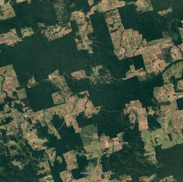
Image: A map of tropical forest losses and gains in the Brazilian Amazon. (Credit: University of Oklahoma)


