
Cloud top temperatures provide information to forecasters about where the strongest storms are located within a tropical cyclone.
Cloud top temperatures provide information to forecasters about where the strongest storms are located within a tropical cyclone. NASA’s Aqua satellite took Tropical Storm Flossie’s cloud top temperatures to get that information.
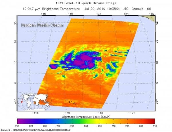
NASA’s Aqua satellite analyzed the storm on July 29, at 6:35 a.m. EDT (1035 UTC) using the Atmospheric Infrared Sounder or AIRS instrument. The stronger the storms, the higher they extend into the troposphere, and they have the colder cloud temperatures.
AIRS found coldest cloud top temperatures as cold as or colder than minus 63 degrees Fahrenheit (minus 53 degrees Celsius) south of the center. At 11 a.m. EDT, the National Hurricane Center analyzed infrared data and said, “Flossie’s low-level center has migrated southward toward the strongest convection and is positioned just north of the coldest cloud tops.”
Read more at NASA/Goddard Space Flight Center
Image: On July 29, 2019 at 6:35 a.m. EDT (1035 UTC) the AIRS instrument aboard NASA's Aqua satellite analyzed cloud top temperatures of Tropical Storm Flossie in infrared light. AIRS found coldest cloud top temperatures (purple) of strongest thunderstorms were as cold as or colder than minus 63 degrees Fahrenheit (minus 53 degrees Celsius). (Credit: NASA JPL/Heidar Thrastarson)


