
NASA’s Aqua satellite passed over the South China Sea and saw Tropical Storm Wipha hugging the southern coast of China.
NASA’s Aqua satellite passed over the South China Sea and saw Tropical Storm Wipha hugging the southern coast of China.
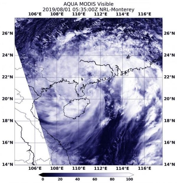
On August 1, 2019 at 1:35 a.m. EDT (0535 UTC), the Moderate Resolution Imaging Spectroradiometer or MODIS instrument aboard NASA’s Aqua satellite provided a visible image of Wipha that showed the center of circulation just off the coast of southern China. The center was just east of the southern tip of the Leizhou Peninsula of southern Guangdong province, and northeast of Hainan Island, China. MODIS imagery shows that despite the center in that area, the bands of thunderstorms that circle the center extend over Hainan Island and into the southern Guangdong Province as well as over the South China Sea.
Read more at NASA/Goddard Space Flight Center
Image: On Aug. 1, 2019, the MODIS instrument aboard NASA's Aqua satellite provided a visible image of Tropical Storm Wipha in the South China Sea. The center of circulation was just off the coast of southern China. (Credit: NASA/NRL)


