
NASA’s Terra satellite used infrared light to gather temperature information from newly developed Tropical Storm Francisco.
NASA’s Terra satellite used infrared light to gather temperature information from newly developed Tropical Storm Francisco. The strongest thunderstorms reach high into the atmosphere and have the coldest cloud top temperatures.
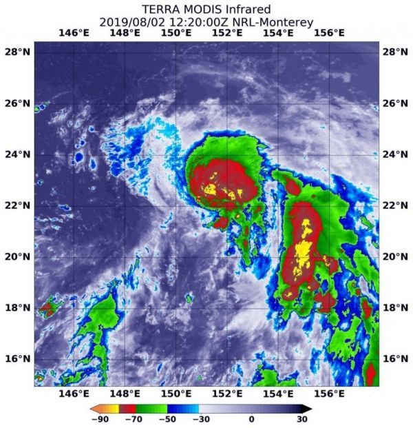
On August 2 at 8:20 a.m. EDT (1220 UTC) the Moderate Imaging Spectroradiometer or MODIS instrument that flies aboard NASA’s Terra satellite found coldest cloud top temperatures as cold as minus 80 degrees Fahrenheit (minus 62.2 Celsius). Cloud top temperatures that cold indicate strong storms with the potential to generate heavy rainfall. Those strongest storms were seen around the center and in fragmented bands of thunderstorms circling the center. Those temperatures were also found in a large band of thunderstorms feeding into the center from the east.
Read more at NASA / Goddard Space Flight Center
Image: On August 2 at 8:20 a.m. EDT (1220 UTC) the MODIS instrument that flies aboard NASA’s Terra satellite showed strongest storms (yellow) in Tropical Storm Francisco around the center and in fragmented bands of thunderstorms circling the center, where cloud top temperatures were as cold as minus 80 degrees Fahrenheit (minus 62.2 Celsius). CREDIT: NASA/NRL


