
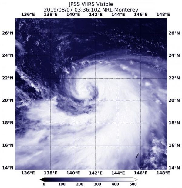
Tropical Storm Krosa continued on its journey northward in the Northwestern Pacific Ocean when NOAA’s NOAA-20 polar orbiting satellite passed overhead and captured a visible image of the strengthening storm in a classic tropical cyclone shape.
Tropical Storm Krosa continued on its journey northward in the Northwestern Pacific Ocean when NOAA’s NOAA-20 polar orbiting satellite passed overhead and captured a visible image of the strengthening storm in a classic tropical cyclone shape.
The Visible Infrared Imaging Radiometer Suite (VIIRS) instrument aboard NOAA-20 provided a visible image of the storm. There’s also a VIIRS instrument aboard the NASA-NOAA Suomi NPP satellite that preceded NOAA-20.
The VIIRS image revealed Krosa had developed the signature “comma shape” of a strengthening storm. A large wide band of thunderstorms were feeding into the low-level center from the south and east of the center.
Read more at NASA/Goddard Space Flight Center
Image: NOAA's NOAA-20 polar orbiting satellite passed over the Northwestern Pacific Ocean and captured a visible image of Tropical Storm Krosa on Aug. 7, 2019. (Credit: NASA/NRL/NOAA)


