
Infrared imagery from NASA’s Aqua satellite shows that Tropical Storm Krosa contains powerful thunderstorms with heavy rain capabilities as it moves toward landfall in southern Japan.
Infrared imagery from NASA’s Aqua satellite shows that Tropical Storm Krosa contains powerful thunderstorms with heavy rain capabilities as it moves toward landfall in southern Japan. Krosa’s center is expected to make landfall in the western part of Shikoku Island, Japan.
On Aug. 14, 2019, the Japan Meteorological Agency has issued warnings for Kyushu, Shikoku and southeastern portions of Honshu. Because Krosa is such a large storm, it is expected to affect all of the big islands of Japan.
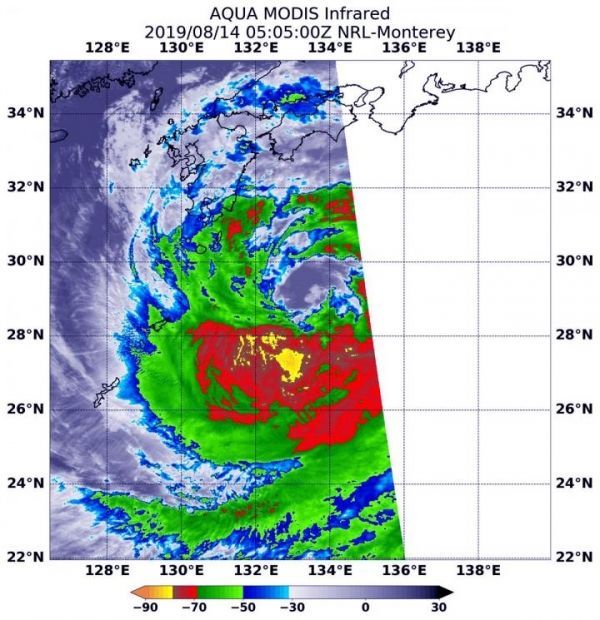
At 12:05 a.m. EDT (0505 UTC), the Moderate Imaging Spectroradiometer or MODIS instrument that flies aboard NASA’s Aqua satellite used infrared light to examine the storm. Infrared data provides temperature information, and the strongest thunderstorms that reach high into the atmosphere have the coldest cloud top temperatures.
Read more at NASA/Goddard Space Flight Center
Image: On Aug. 14, 2019 at 12:05 a.m. EDT (0505 UTC), NASA's Aqua satellite found strongest thunderstorms (yellow) in Krosa in a small area southwest of the center where cloud top temperatures were as cold as minus 80 degrees Fahrenheit (minus 62.2 Celsius). That area was surrounded by a much larger area (red) with powerful storms as cold as minus 70 degrees Fahrenheit (minus 56.6 Celsius). (Credit: NASA/NRL)


