
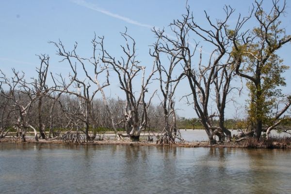
Florida has lost much of the mangrove forests that once bordered its coasts and estuaries to development and sea-level rise.
Florida has lost much of the mangrove forests that once bordered its coasts and estuaries to development and sea-level rise. Current rates of sea-level rise combined with increasing climate variability could accelerate the loss of mangrove-lined coastlines, according to new USGS research published in the journal Nature Communications. These findings will help resource managers understand whether mangrove-forested islands and shorelines can be maintained as the climate changes and sea levels rise and how water management may help mitigate these changes.
Scientists drill a piston core in Florida Bay sediment
“From previous studies, we know that the mangrove zone in South Florida shifted inland as sea level rose and estuaries covered what was previously mangrove forest during the late Holocene,” said USGS research geologist Miriam Jones, the study’s lead author. “This new research is one of the most detailed studies to pinpoint how fast the transition from mangrove forest to estuary happened during that time.”
The USGS research comes at a time when state and federal government agencies and many other partners are undertaking one of the world’s largest and most ambitious ecosystem restoration efforts: to help recover the health and natural productivity of the Greater Everglades ecosystem, which includes Florida Bay.
Mangroves provide important natural services that benefit people and wildlife. They act as buffers against storm surges and rising seas, help reduce erosion and protect coastal communities. They also serve as nesting sites for birds, act as critical habitat for endangered and threatened species and provide sheltered nursery areas for commercially valuable fish and shellfish. They are an important plant community in Florida Bay, the shallow, salty water body that lies between the Florida Keys and the state’s southern tip, mostly within the boundary of Everglades National Park.
Continue reading at USGS.
Image via USGS.


