
Tropical Storm Krosa continued to erode after it moved into the Sea of Japan and satellite data showed it as a ragged and shapeless storm on August 16, 2019.
Tropical Storm Krosa continued to erode after it moved into the Sea of Japan and satellite data showed it as a ragged and shapeless storm on August 16, 2019.
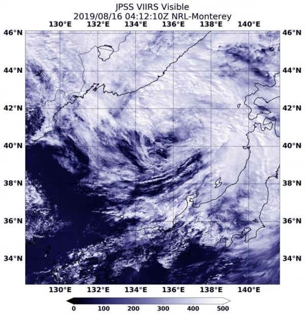
The center of Tropical Storm Krosa’s circulation was difficult to pinpoint in the Aug. 16 visible image from the Visible Infrared Imaging Radiometer Suite (VIIRS) instrument aboard the NOAA-20 satellite. NOAA-20 passed over the Sea of Japan at 12:12 a.m. EDT (0412 UTC) and the VIIRS instrument provided a view of the shapeless storm. The bulk of clouds associated with the storm was north of the center.
The Joint Typhoon Warning Center or JTWC issued their final bulletin on Krosa at 0300 UTC on Aug. 16 (11 p.m. EDT on Aug. 15). At that time Tropical Storm Krosa was located near 39.4 degrees north latitude and 134.9 east longitude, about 296 miles west-southwest of Misawa, Japan. Krosa was moving to the north-northeast and had maximum sustained winds 35 knots (40 mph).
Read more at NASA/Goddard Space Flight Center
Image: NOAA's NOAA-20 satellite provided a look at Tropical Storm Krosa as it was becoming extra-tropical in the Sea of Japan on Aug 16 at 12:12 a.m. EDT (0412 UTC). (Credit: NOAA/NRL)


