
In the late evening hours of August 17, 1969, a catastrophic storm named Hurricane Camille slammed into the Gulf Coast.
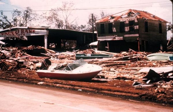
In the late evening hours of August 17, 1969, a catastrophic storm named Hurricane Camille slammed into the Gulf Coast. A Category 5 hurricane, with sustained winds of 175 mph and a storm surge of more than 24 feet, Camille devastated much of coastal Mississippi, Alabama and Louisiana. More than 250 people lost their lives and damage was estimated at about $10 billion in 2019 dollars.
Decades later, scientists reviewing archived satellite and radar data learned that it was the second-most intense hurricane to hit the continental United States in recorded history—a grim statistic that remains 50 years later.
In 1969 however, weather satellites were still relatively new and limited in their capabilities. Indeed, the first successful weather satellite launched into orbit only nine years before Camille. But it was a big step, as it began the era of space-based weather monitoring and prediction.
The Television Infra-Red Observation Satellite (TIROS-1) consisted of two television cameras housed in a 270-lb satellite. TIROS-1 launched on April 1, 1960, and it was the world’s first satellite that monitored the Earth's cloud cover and weather patterns. Its first image was a fuzzy picture of thick bands and clusters of clouds over the United States. Though TIROS-1 functioned for just 78 days, it provided groundbreaking views of our planet.
Continue reading at NOAA.
Image via NOAA.


