
NASA’s Aqua satellite provided a view of newly formed Tropical Storm Chantal in the North Atlantic Ocean.
NASA’s Aqua satellite provided a view of newly formed Tropical Storm Chantal in the North Atlantic Ocean. The image revealed that the storm formed despite being battered by outside winds.
The third named storm of the Atlantic Ocean hurricane season formed around 11 p.m. EDT on Aug. 20, far from land and almost 500 miles southeast of Halifax, Nova Scotia, Canada.
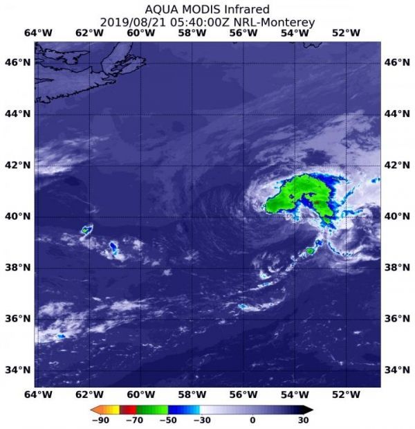
NASA’s Aqua satellite obtained an infrared view of the storm nine hours later. An instrument aboard Aqua uses infrared light to analyze the strength of storms by providing temperature information about the system’s clouds. The strongest thunderstorms that reach high into the atmosphere have the coldest cloud top temperatures.
On Aug. 21 at 8:20 a.m. EDT (1220 UTC), the Moderate Imaging Spectroradiometer or MODIS instrument that flies aboard NASA’s Aqua satellite gathered infrared data on Chantal. The strongest storms were east of the center of circulation and indicative of vertical wind shear, outside westerly winds pushing against the storm. Storms east of the center had cloud top temperatures as cold as minus 50 degrees Fahrenheit (minus 45.5 Celsius).
Read more at: NASA/Goddard Space Flight Center
On Aug. 21 at 8:20 a.m. EDT (1220 UTC), the MODIS instrument that flies aboard NASA's Aqua satellite showed strongest storms (yellow) in Tropical Storm Chantal were east of center, where cloud top temperatures in those areas were as cold as minus 50 degrees Fahrenheit (minus 45.5 Celsius). (Photo Credit: NASA/NRL)


