
Geothermal manifestations at Earth’s surface can be mapped and characterized by a variety of well-established exploration methods.
Geothermal manifestations at Earth’s surface can be mapped and characterized by a variety of well-established exploration methods. However, mapping hydrothermal vents in aquatic environments is more challenging as conventional methods can no longer be applied. In fact, chemical composition of lake water may indicate inflow of fluids from a volcanic system, but it does not provide spatial information on the location of hydrothermal vents, their abundance and current state of activity.
Changes in the behaviour of hydrothermal vents may be indicative of changes in the volcanic system underneath, thus being a useful precursor for the next generation of early warning systems. Increased volcanic activity beneath volcanic lakes could also trigger increased gas input, in particular CO2, which could again result in catastrophic gas outbursts as reported from Lake Nyos or Lake Monoun in Cameroon. New exploration approaches will help improving site-specific risk assessment and monitoring concepts by taking a closer look at hydrothermal vents.
Read more at GFZ Geoforschungszentrum Potsdam, Helmholtz Centre
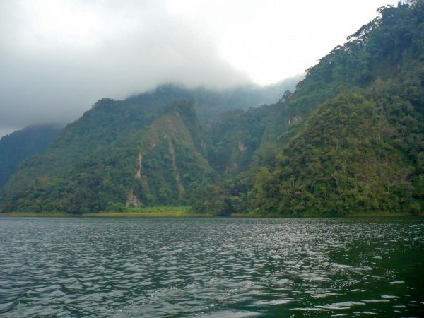
Image: Steep crater wall of Ngozi volcano in the Poroto Ridge Forest Reserve, Tanzania (Credit: Egbert Jolie/GFZ)


