
Over the last day, winds outside of Tropical Storm Chantal have been weakening the storm in the North Atlantic Ocean.
Over the last day, winds outside of Tropical Storm Chantal have been weakening the storm in the North Atlantic Ocean. When NASA’s Aqua satellite passed over the storm from its orbit in space on August 22, the storm had weakened to a depression and strongest storms were still confined to the northeast of the center.
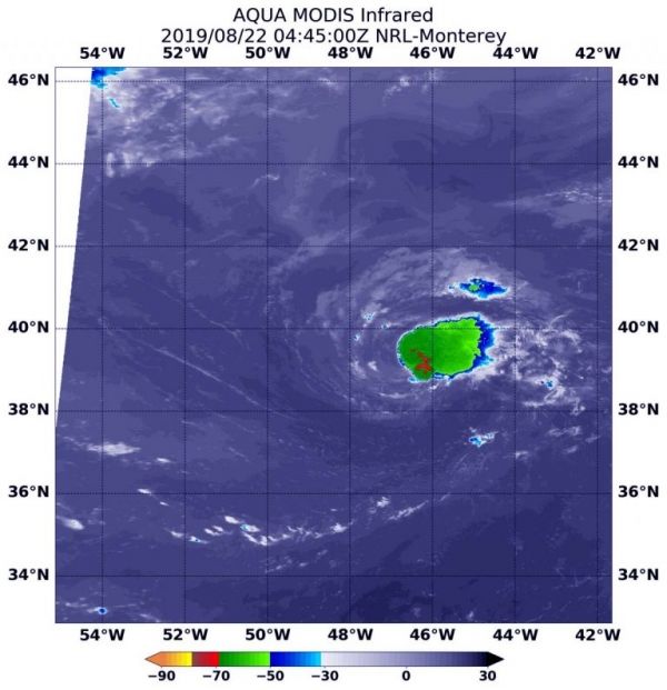
On Aug. 22 at 12:45 a.m. EDT (0445 UTC), the Moderate Imaging Spectroradiometer or MODIS instrument that flies aboard NASA’s Aqua satellite used infrared light to analyze the strength of storms by providing temperature information about the system’s clouds. The strongest thunderstorms that reach high into the atmosphere have the coldest cloud top temperatures.
The strongest storms were still east of the center of circulation, although they shifted to the northeast today. That displacement of strongest storms from around the center is indicative of vertical wind shear, outside westerly winds pushing against the storm. Storms east of the center had cloud top temperatures as cold as minus 70 degrees Fahrenheit (minus 56.6 Celsius).
Read more at NASA / Goddard Space Flight Center
Image: On Aug. 22 at 12:45 a.m. EDT (0445 UTC), the MODIS instrument that flies aboard NASA’s Aqua satellite showed strongest storms (red) in Tropical Depression Chantal were still northeast of center, where cloud top temperatures in those areas were as cold as minus 70 degrees Fahrenheit (minus 56.6 Celsius). CREDIT: NASA/NRL


