
Visible and infrared imagery from NASA’s Terra satellite revealed that strong wind shear was adversely affecting Tropical Depression Erin, located about 200 miles off the Carolina coast.
Visible and infrared imagery from NASA’s Terra satellite revealed that strong wind shear was adversely affecting Tropical Depression Erin, located about 200 miles off the Carolina coast.
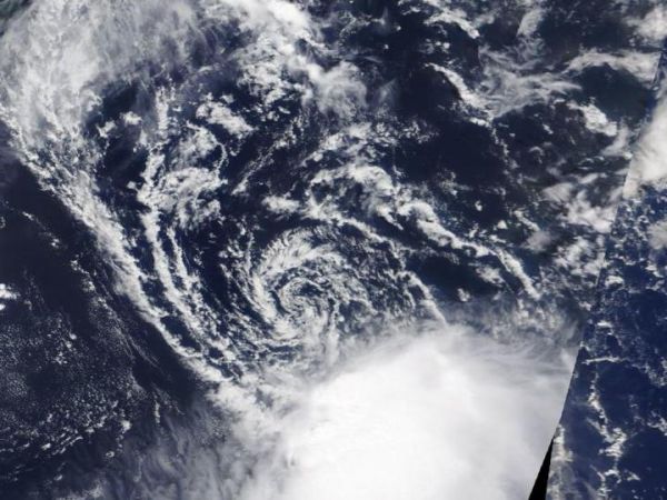
On Aug. 27, the Moderate Resolution Imaging Spectroradiometer or MODIS instrument aboard NASA’s Terra satellite provided a visible image of Tropical Depression Erin. In the image, Erin appeared as a swirl of clouds around its center with most of its clouds and thunderstorms pushed southeast of center. Strong northwesterly vertical wind shear was pushing at the storm.
Despite fighting wind shear on Aug. 27, Tropical Depression 6 strengthened into a tropical storm by 11 p.m. EDT, and was renamed Erin.
Infrared imagery from NASA’s Aqua satellite confirmed that wind shear was still affecting Tropical Storm Erin on Wednesday, August 28 at 3:25 a.m. EDT (0725 UTC). Infrared imagery reveals temperature data, and showed the only strong storms in the tropical storm were being pushed to the southeast. Strongest storms were as cold as minus 70 degrees Fahrenheit (minus 56.6 degrees Celsius).
Read more at NASA/Goddard Space Flight Center
Image: On Aug. 27, 2019 the MODIS instrument aboard NASA's Terra satellite provided a visible image of Tropical Depression Erin that showed the storm was being affected by vertical wind shear. (Credit: NASA Worldview, Earth Observing System Data and Information System (EOSDIS))


