
As Hurricane Dorian continued to lash the coast of the Carolinas NASA’s IMERG assessed the rainfall the storm generated and NASA’s Aqua satellite provided a look at the temperatures of the cloud tops to assess strength.
As Hurricane Dorian continued to lash the coast of the Carolinas NASA’s IMERG assessed the rainfall the storm generated and NASA’s Aqua satellite provided a look at the temperatures of the cloud tops to assess strength.
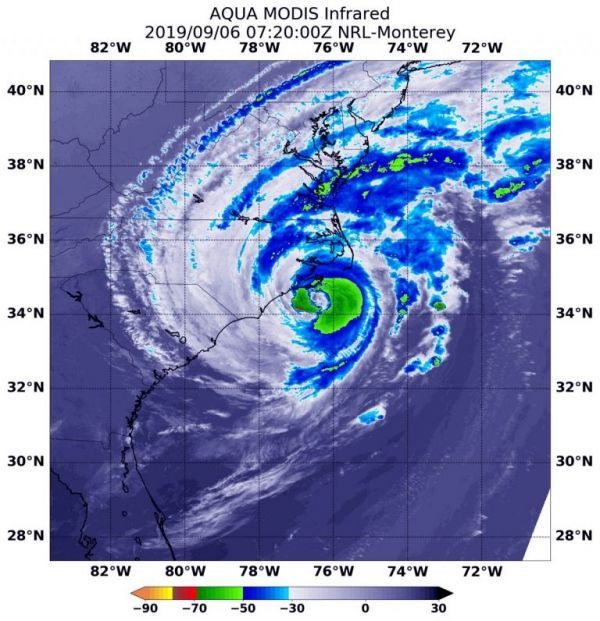
By Friday morning, September 6, Hurricane Dorian was located off the coast of North Carolina, having generated tornadoes the previous day as the northern rainband came ashore in North Carolina. NASA’s satellite-based real time precipitation estimates suggest that, during the past day, most of the areas experiencing over 10 inches of rain accumulation remained offshore, while Dorian did drop heavy rain on South Carolina and North Carolina.
IMERG showed largest rainfall amounts of more than 36 inches over the Bahamas and in an area off the coast of northeastern Florida. A large area of rainfall between 16 and 24 inches fell off the coast from South Carolina to the Bahamas and in a small area far off the North Carolina coast.
The National Weather Service in Charleston, South Carolina noted that 3.06” fell yesterday, Sept. 5. In Wilmington, North Carolina, a rainfall record was set when Dorian dropped 8.58 inches. New Bern, North Carolina also set a rainfall record, when Dorian dropped 2.95 inches there.
Read more at NASA Goddard Space Flight Center
Image: On Sept. 6 at 3:20 a.m. EDT (0720 UTC), NASA’s Aqua satellite provided temperature data on Hurricane Dorian to show where strongest storms were located (red) with cloud top temperatures as cold as minus 70 degrees Fahrenheit (minus 56.6 Celsius). (Credit: NASA/NRL)


