
Fires in Southeast Asian peatlands release huge amounts of carbon, along with deadly smoke. Now, new satellite measurements of soil moisture may offer a promising approach to reducing those fires and their widespread haze.
Fires in Southeast Asian peatlands release huge amounts of carbon, along with deadly smoke. Now, new satellite measurements of soil moisture may offer a promising approach to reducing those fires and their widespread haze.
When large areas of carbon-rich soil catch fire, the blaze emits massive amounts of carbon into the atmosphere and creates a thick haze some residents of Southeast Asia know all too well. In 2015, the haze from peatland fires was fatal, responsible for more than 100,000 premature deaths in Indonesia, Malaysia and Singapore.
Because of how they accumulate organic material for long periods of time, undisturbed peatlands are considered one of the most effective natural ecosystems for carbon storage. So large fires come at a huge cost to human health and sustainability.
Read more at: Stanford University
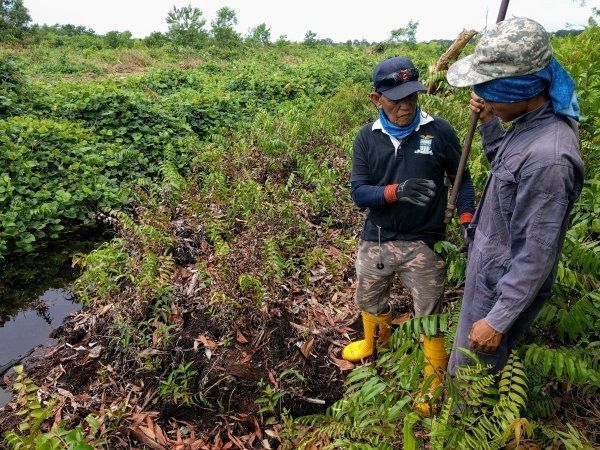
Workers install soil moisture and water table depth sensors in a burned peatland in Badas, Brunei Darussalam. (Photo credit: Nathan Dadap)


