
NASA’s Aqua satellite passed over the Central Atlantic Ocean and provided a visible view of Tropical Storm Gabrielle that helped pinpoint its strongest side.
NASA’s Aqua satellite passed over the Central Atlantic Ocean and provided a visible view of Tropical Storm Gabrielle that helped pinpoint its strongest side.
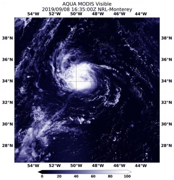
On Sept. 8, 2019 at 2:35 p.m. EDT (1635 UTC), the Moderate Resolution Imaging Spectroradiometer or MODIS instrument aboard NASA’s Aqua satellite provided a visible image of Gabrielle that showed strongest thunderstorms northeast of the center.
The MODIS image also showed that there were also fragmented bands of strong thunderstorms south and southwest of the center.
On Sept. 9, NOAA’s National Hurricane Center or NHC said, “Deep convection associated with Gabrielle has become somewhat less organized overnight with the center located near the northeastern portion of the coldest cloud tops.”
Read more at NASA/Goddard Space Flight Center
Image: On Sept. 8, 2019 at 2:35 p.m. EDT (1635 UTC) the MODIS instrument aboard NASA's Aqua satellite provided a visible image of Gabrielle moving through the Central Atlantic Ocean. (Credit: NASA/NRL)


