
NASA’s Terra satellite passed over the northwestern Pacific Ocean and provided a final view of Tropical Depression Peipah.
NASA’s Terra satellite passed over the northwestern Pacific Ocean and provided a final view of Tropical Depression Peipah.
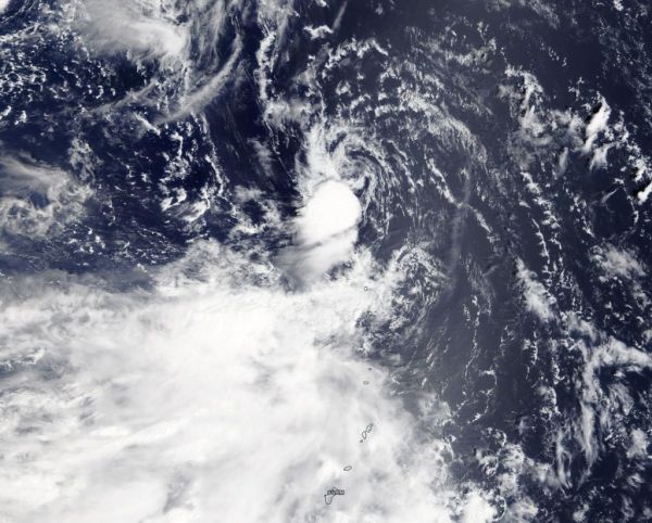
Peipah developed on Sept. 14 as a depression. It was the seventeenth (17W) tropical depression of the Northwestern Pacific Ocean typhoon season. On Sept. 15 at 11 a.m. EDT (1500 UTC) the depression strengthened into a tropical storm with maximum sustained winds near 35 knots (40 mph) and was renamed Peipah. On Sept. 16, Peipah weakened back to a depression.
On Sept. 16, the Moderate Resolution Imaging Spectroradiometer or MODIS instrument aboard NASA’s Terra satellite provided a visible image of Peipah. The storm had diminished to a swirl of clouds, with only a small area of strong thunderstorms southwest of the center. Wind shear from the northeast pushed those storms southwest of center.
Read more at NASA / Goddard Space Flight Center
Image: On Sept. 16, the MODIS instrument aboard NASA’s Terra satellite provided a visible image of Peipah. The storm had diminished to a swirl of clouds, with only a small area of strong thunderstorms southwest of the center. Wind shear from the northeast pushed those storms southwest of center. Credit: NASA Worldview, Earth Observing System Data and Information System (EOSDIS)


