
NASA’s Terra Satellite provided a visible image of Hurricane Humberto when it was off the coast of the Carolinas and slowly moving north. The satellite image revealed that Humberto is a large storm.
NASA’s Terra Satellite provided a visible image of Hurricane Humberto when it was off the coast of the Carolinas and slowly moving north. The satellite image revealed that Humberto is a large storm.
On Sept. 16, the Moderate Imaging Spectroradiometer or MODIS instrument that flies aboard NASA’s Terra satellite provided a visible image of Hurricane Humberto. The storm appears large in the imagery as it stretches from Florida to North Carolina, and has a tail extending to the northeast for hundreds of miles into the western Atlantic Ocean north of Bermuda. In the image, powerful thunderstorms circled the eye, which was also visible.
Humberto appears to have grown in size, and although it is located off the U.S. East coast, its extent is reaching Bermuda. The National Hurricane Center or NHC issued a Tropical Storm Warning for Bermuda on Sept. 17. Humberto may bring periods of heavy rain to Bermuda beginning Tuesday, with rainfall accumulations of 1 to 3 inches expected. Large swells generated by Humberto will increase along the coast of Bermuda by Wednesday.
Read more at: NASA/Goddard Space Flight Center
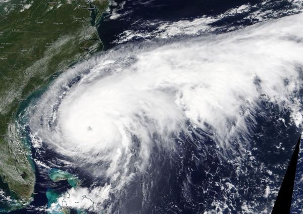
On Sept. 15, the MODIS instrument that flies aboard NASA's Terra provided a visible image of Hurricane Humberto. The storm appears quite large in the imagery as it stretches from Florida to North Carolina, and has a tail extending to the northeast for hundreds of miles into the western Atlantic Ocean north of Bermuda. In the image, powerful thunderstorms circled the eye, which was also visible. (Photo Credit: NASA Worldview, Earth Observing System Data and Information System EOSDIS)


