
Hurricane Kiko continued to track west through the Eastern Pacific Ocean when NASA-NOAA’s Suomi NPP satellite passed overhead and provided a view of the storm.
Hurricane Kiko continued to track west through the Eastern Pacific Ocean when NASA-NOAA’s Suomi NPP satellite passed overhead and provided a view of the storm. Satellite imagery revealed an elongated shape, which indicated wind shear was still affecting Kiko.
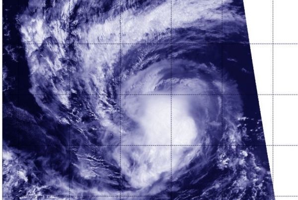
The Visible Infrared Imaging Radiometer Suite (VIIRS) instrument aboard Suomi NPP provided an infrared image of the storm on Sept. 16 at 6:12 p.m. EDT (2212 UTC). The VIIRS image and microwave satellite imagery indicates that the northeasterly wind shear was still affecting Kiko.
In general, wind shear is a measure of how the speed and direction of winds change with altitude. Tropical cyclones are like rotating cylinders of winds. Each level needs to be stacked on top each other vertically in order for the storm to maintain strength or intensify. Wind shear occurs when winds at different levels of the atmosphere push against the rotating cylinder of winds, weakening the rotation by pushing it apart at different levels.
Read more at NASA / Goddard Space Flight Center
Image: Hurricane Kiko continued to weaken on Sept. 16 at 6:12 p.m. EDT (2212 UTC) when NASA-NOAA’s Suomi NPP satellite passed over the Eastern Pacific Ocean and the VIIRS instrument aboard captured this image of the storm. Credit: NASA/NOAA/NRL


