
New technology gives unprecedented views of hurricane.
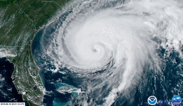
This season’s Humberto isn’t the first tropical cyclone in the Atlantic Basin to be given the name. In fact, it’s the fifth Hurricane Humberto to emerge in the Atlantic, but this time, NOAA is watching through the sophisticated Advanced Baseline Imager (ABI) of GOES-16.
Humberto replaced the name Hugo on the World Meteorological Organization’s list of Atlantic hurricane names after Hurricane Hugo’s devastation in 1989 prompted its name to be retired. Since 1979, all annual lists of Atlantic tropical cyclone names are repeated after six years unless a storm is exceptional enough to warrant retirement. So far, no hurricane named Humberto has been big or bad enough.
That’s not to say we didn’t have any memorable Humbertos. In 1995, Hurricane Humberto had sustained winds of 110 mph at one point — making it a strong Category 2 hurricane — but it remained well out at sea. In 2001, another Category 2 Hurricane Humberto brought gusty winds and heavy rain, as it passed to the west of Bermuda.
Continue reading at NOAA
Image via NOAA


