
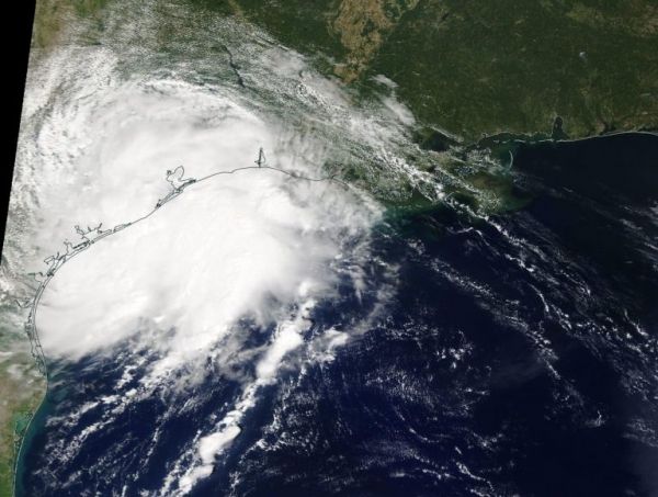
NASA’s Terra satellite passed over the western Gulf of Mexico during the early afternoon of Sept. 17 and captured a visible image of the newly formed Tropical Depression 11.
NASA’s Terra satellite passed over the western Gulf of Mexico during the early afternoon of Sept. 17 and captured a visible image of the newly formed Tropical Depression 11.
The eleventh tropical depression developed during the late morning of Sept. 17. Soon afterward it briefly strengthened into a tropical storm and was re-named Imelda. Then Imelda made landfall near Freeport, Texas. A Tropical Storm Warning was in effect from Sargent to Port Bolivar, Texas.
On Sept. 17 at 1:30 p.m. EDT (17:30 UTC), the Moderate Imaging Spectroradiometer or MODIS instrument that flies aboard NASA’s Terra satellite provided a visible picture of the storm shortly after it made landfall on the southeastern Texas coastline. The storm appeared to be slightly elongated, and when Terra passed overhead the western quadrant of the storm was already over land while the eastern half was over the western Gulf of Mexico.
Read more at NASA / Goddard Space Flight Center
Image: On Sept. 17 at 1:30 p.m. EDT (17:30 UTC), the MODIS instrument that flies aboard NASA’s Terra satellite showed newly formed Tropical Depression 11 just after it made landfall along the Texas coast. Credit: NASA Worldview


