
Hurricane Kiko weakened to a tropical storm, but imagery from NASA-NOAA’s Suomi NPP satellite showed that the storm has maintained strength in the circular area of powerful storms around the low-level center.
Hurricane Kiko weakened to a tropical storm, but imagery from NASA-NOAA’s Suomi NPP satellite showed that the storm has maintained strength in the circular area of powerful storms around the low-level center.
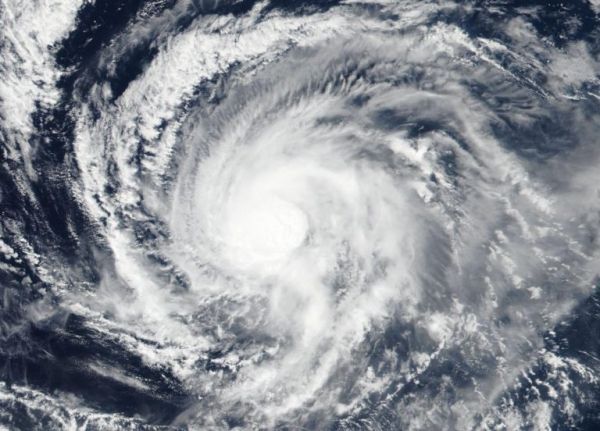
The Visible Infrared Imaging Radiometer Suite (VIIRS) instrument aboard Suomi NPP provided a visible image of Kiko on Sept. 17 revealed that powerful storms circled the low-level center. The image showed strong bands of thunderstorms located over the northern and western quadrants of the storm.
Hurricanes are the most powerful weather event on Earth. NASA’s expertise in space and scientific exploration contributes to essential services provided to the American people by other federal agencies, such as hurricane weather forecasting.
Read more at NASA / Goddard Space Flight Center
Image: NASA-NOAA’s Suomi NPP satellite passed over Tropical Storm Kiko on Sept. 17 and revealed a circular area of powerful storms around the low-level center. The image showed strong bands of thunderstorms were located over the northern and western quadrants of the storm. Credit: NASA Worldview, Earth Observing System Data and Information System (EOSDIS)


