
NASA’s Aqua satellite captured an image of Tropical Storm Narda along Mexico’s west coast in the Eastern Pacific Ocean.
NASA’s Aqua satellite captured an image of Tropical Storm Narda along Mexico’s west coast in the Eastern Pacific Ocean. Satellite data revealed the potential for heavy rainfall within Narda, and warnings are in effect for portions of western Mexico.
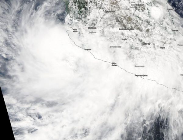
Narda formed as Tropical Depression 16E on Saturday, Sept. 28 and intensified into a tropical storm late in the day. When it became a tropical storm it was renamed “Narda.”
On Sept. 30, the Moderate Imaging Spectroradiometer or MODIS instrument that flies aboard NASA’s Aqua satellite provided a visible image of Narda. The MODIS image showed the cyclone continues to produce a large area of deep convection near and to the west of its center. Earlier in the day, at 5 a.m. EDT, infrared satellite data showed that Narda continued to produce very intense deep convection (strong thunderstorms) with cloud tops colder than minus 80 degrees Celsius (minus 112 degrees Fahrenheit). NASA research has shown that storms with cloud top temperatures that cold can produce heavy rainfall.
Read more at NASA / Goddard Space Flight Center
Image: On Sept. 29 the MODIS instrument that flies aboard NASA’s Aqua satellite provided a visible image of Tropical Storm Narda along Mexico’s western coast. Credit: NASA Worldview


