
The U.S. Geological Survey today unveiled a new web-based interactive map that marks an important step toward mapping areas that could be at higher risk for future landslides
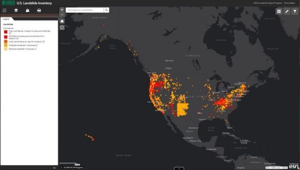
The U.S. Geological Survey today unveiled a new web-based interactive map that marks an important step toward mapping areas that could be at higher risk for future landslides. In collaboration with state geological surveys and other federal agencies, USGS has compiled much of the existing landslide data into a searchable, web-based interactive map called the U.S. Landslide Inventory Map.
“Although landslides occur in every state, our understanding of landslide hazards at the national scale is limited because landslide information across the U.S. is incomplete, varies in quality, accessibility and extent and what is known is not collected in a central location,” said Jonathan Godt, USGS program coordinator for Landslide Hazards.
Until now, no federal agency sought to undertake the monumental task of systematically cataloging landslide occurrence across the U.S. Existing digital data on landslide occurrence are held by a range of federal, state, and local government agencies, and no central point of access has previously been available.
Continue reading at USGS.
Image via USGS.


