
Satellite views of the tallest peak in the continental US show its rugged beauty.
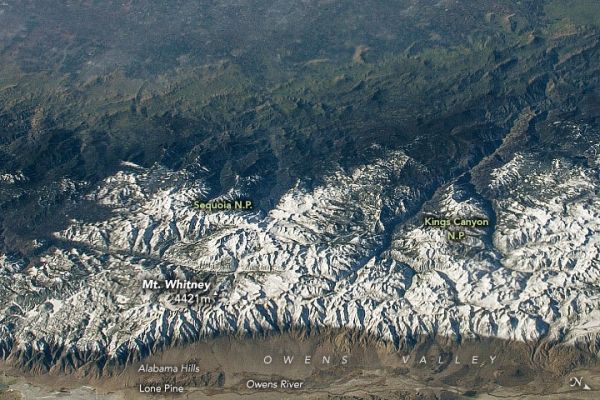
Many hikers are lured to California’s Mount Whitney each year by the desire to stand atop the tallest peak in the continental United States. There’s more than one way to approach the 4421-meter (14,505-foot) summit in the Sierra Nevada. But each has its challenges: rapid elevation gain, rugged topography, and brutal weather can test even the most seasoned climbers.
A popular approach is from the eastern side of the range via the Mount Whitney Trail (assuming you win a permit in the Mount Whitney Lottery). A 200-mile drive north from Los Angeles puts you in Lone Pine, a small town in Owens Valley. The valley is visible at the bottom of this photograph, which shows the Sierra Nevada and Mount Whitney as observed from the east on December 19, 2018, by an astronaut on the International Space Station.
The Owens River is visible as a thin, dark line winding along the valley floor. Snowmelt helps feed the river, which in turn feeds an aqueduct system (not visible) that supplies water to Los Angeles. In the early 20th Century, water was diverted from Owens Lake and left the lakebed mostly dry (visible to the bottom-left).
Continue reading at NASA Earth Observatory
Image via NASA Earth Observatory


