
NASA-NOAA’s Suomi NPP satellite provided forecasters at the Joint Typhoon Warning Center with a visible image of Tropical Storm Neoguri that showed it had become more organized over the previous 24 hours.
NASA-NOAA’s Suomi NPP satellite provided forecasters at the Joint Typhoon Warning Center with a visible image of Tropical Storm Neoguri that showed it had become more organized over the previous 24 hours.
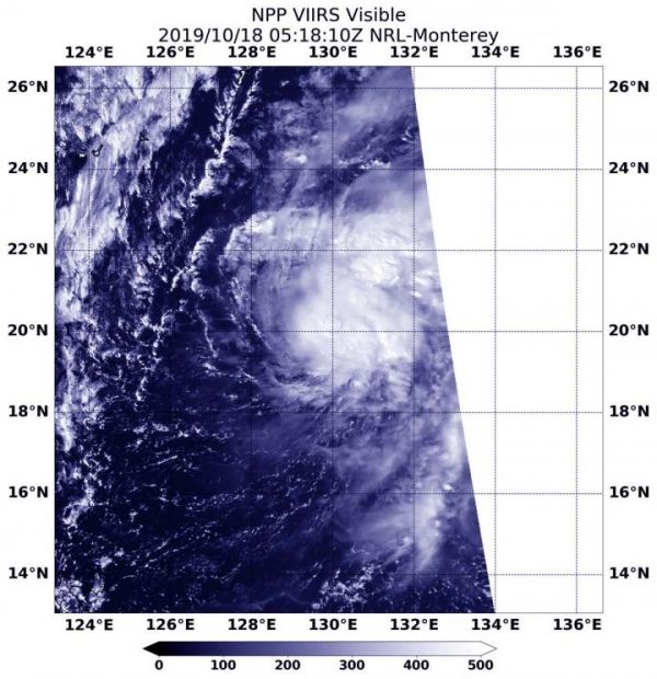
Tropical Depression 21W lacked organization for a couple of days until early on Oct. 18 when the Suomi NPP satellite passed overhead and showed it had consolidated. The storm had strengthened from a depression to a tropical storm on Oct. 18.
The Visible Infrared Imaging Radiometer Suite (VIIRS) instrument aboard Suomi NPP provided a visible image of Neoguri that revealed powerful storms circled the low-level center. The image showed that bands of thunderstorms were also developing around the eastern quadrant.
Read more at NASA/Goddard Space Flight Center
Image: NASA-NOAA's Suomi NPP satellite passed over Tropical Storm Neoguri on Oct. 18 at 1:18 a.m. EDT (0518 UTC), and revealed powerful storms around the low-level center. The image showed strong bands of thunderstorms developing east of the center. (Credit: NASA/NRL)


