
A new study from Caltech finds that so-called "slow slip" or "silent" earthquakes behave more like regular earthquakes than previously thought.
A new study from Caltech finds that so-called "slow slip" or "silent" earthquakes behave more like regular earthquakes than previously thought. The discovery opens the door for geoscientists to use these frequent and nondestructive events as an easy-to-study analog that will help them find out what makes earthquakes tick.
Slow-slip events were first noted about two decades ago by geoscientists tracking otherwise imperceptible shifts in the earth using GPS technology. They occur when faults grind incredibly slowly against each other, like an earthquake in slow motion. For example, a slow-slip event that occurs over the course of weeks might release the same amount of energy as a minute-long magnitude-7.0 earthquake. Because they occur deep in the earth and release energy so slowly, there is very little deformation at the surface, although the slow events might affect an area of thousands of square kilometers. As such, they were only noted when GPS technology was refined to the point that it could track those very minute shifts. Slow-slip events also do not occur along every fault; so far, they have been spotted in just a handful of locations including the Pacific Northwest, Japan, Mexico, and New Zealand.
As they have only just begun to be detected and cataloged, a lot remains unknown about them, says Jean-Philippe Avouac, Caltech's Earle C. Anthony Professor of Geology and Mechanical and Civil Engineering. "There's a lot of uncertainty. You can't study them using traditional seismological techniques because the signal they create is too faint and gets lost in the noise from human activities as well as from natural geological processes like ocean waves, rivers, and winds." Before Avouac's group began this study, there were not enough documented slow-slip events to determine their scaling properties reliably, he says.
Read more at California Institute of Technology
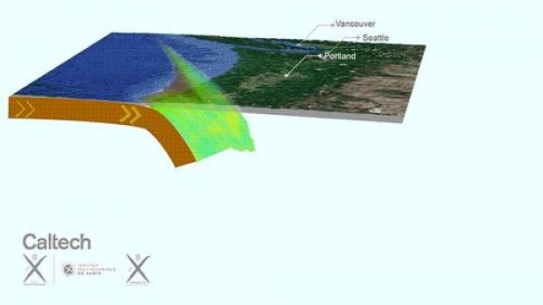
Image: GPS stations reveal activity beneath Cascadia where the oceanic floor slides beneath North America. The plate interface is locked at shallow depths (the shaded area), but we see recurring slow-slip events (in blue) that unzip the plate interface, generating tremors (the black dots). (Credit: Jean-Philippe Avouac/Caltech)


