
Satellite imagery displays impacts of raging wildfires.
Fueled by hot weather, low humidity, and bursts of strong easterly and northeasterly winds, several large wildfires ignited along the West Coast of the United States and Mexico in late October 2019. Seasonal Santa Ana and Diablo winds blew in from hot, dry areas and accelerated down mountain ranges, creating conditions where a few sparks and small brush fires could quickly get whipped up into large conflagrations.
U.S. weather and fire forecasters delivered “red flag warnings” to Californians, predicting extreme fire-promoting conditions through October 29 in various parts of the state. On October 25, forecasts for Northern California called for steady 25 to 45 mile per hour winds and humidity between 9 to 16 percent. In Southern California, temperatures were expected to range from 87 to 97 degrees Fahrenheit (30 to 36 degrees Celsius), with humidity between 2 and 9 percent and winds gusting as high as 65 miles per hour.
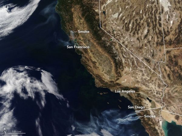
On October 25, 2019, the Moderate Resolution Imaging Spectroradiometer (MODIS) on NASA’s Terra satellite acquired a natural-color image (top) with a wide view of fires near the Pacific Coast. The second image, also from Terra MODIS, focuses on the smoke plume from the Kincade fire in Sonoma County as it appeared on October 24. Images captured that day by the GOES East weather satellite show the wind-driven circulation of clouds and smoke from the fire.
Continue reading at NASA Earth Observatory
Image via NASA Earth Observatory


