
Satellite images, drone photos and even Google Earth could help identify communities most at risk for getting one of the world’s worst tropical diseases.
Satellite images, drone photos and even Google Earth could help identify communities most at risk for getting one of the world’s worst tropical diseases.
A team led by the University of Washington and Stanford University has discovered clues in the environment that help identify transmission hotspots for schistosomiasis, a parasitic disease that is second only to malaria in its global health impact. The research, publishing the week of Oct. 28 in the Proceedings of the National Academy of Sciences, uses rigorous field sampling and aerial images to precisely map communities that are at greatest risk for schistosomiasis.
“This is a game-changer for developing-country public health agencies, because it will make it possible for them to efficiently find the villages that need their help the most,” said lead author Chelsea Wood, an assistant professor in the UW School of Aquatic and Fishery Sciences.
Read more at University of Washington
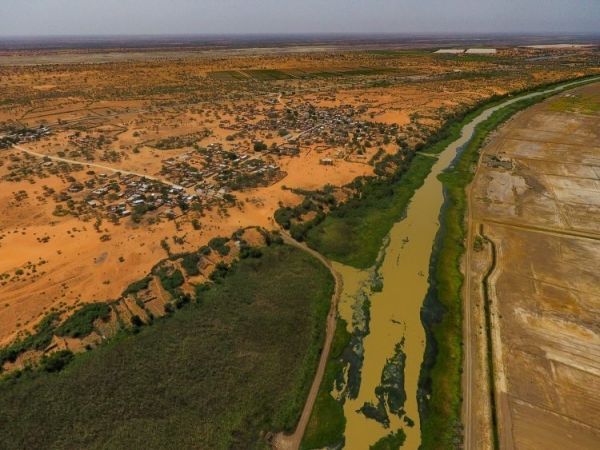
Image: A drone image showing a village in northwestern Senegal and agricultural land, separated by a river with lush vegetation. Researchers use rigorous field sampling and aerial images to precisely map communities that are at greatest risk for schistosomiasis infection. CREDIT: Andrew Chamberlin / Stanford University


