
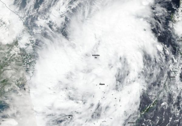
NASA-NOAA’s Suomi NPP satellite captured an image of Tropical Storm Matmo as it developed in the South China Sea, off the coast of Vietnam.
NASA-NOAA’s Suomi NPP satellite captured an image of Tropical Storm Matmo as it developed in the South China Sea, off the coast of Vietnam. The storm is expected to make a landfall in central southeastern Vietnam later on Oct. 30.
Visible imagery from NASA satellites help forecasters understand if a storm is organizing or weakening. The Visible Infrared Imaging Radiometer Suite (VIIRS) instrument aboard Suomi NPP provided a visible image of Matmo on Oct. 30 and found the storm taking on a much more rounded shape than the previous day.
The shape of the storm is a clue to forecasters that a storm is either strengthening or weakening. If a storm takes on a more rounded shape it is getting more organized and strengthening. Conversely, if it becomes less rounded or elongated, it is a sign the storm is weakening.
At 5 a.m. EDT (0900 UTC) on Oct. 30, the center of Matmo was near latitude 13.2 degrees north and longitude 111.0 degrees east. The post-tropical cyclone was moving toward the west-northwest. Maximum sustained winds associated with this system are near 46 mph (40 knots/74 kph) with higher gusts.
Read more at NASA/Goddard Space Flight Center
Image: NASA-NOAA's Suomi NPP satellite passed over Tropical Storm Matmo in the South China Sea on Oct. 30, 2019 as it was nearing the coast of southeastern central Vietnam. (Credit: NASA Worldview, Earth Observing System Data and Information System (EOSDIS))


