
NASA’s Terra Satellite provided a visible image of Post-Tropical Cyclone Rebekah as it continued moving in an easterly direction through the North Atlantic Ocean.
NASA’s Terra Satellite provided a visible image of Post-Tropical Cyclone Rebekah as it continued moving in an easterly direction through the North Atlantic Ocean. Satellite data has confirmed that Rebekah is now a post-tropical cyclone.
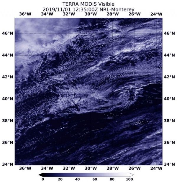
At 5 a.m. EDT (0900 UTC) on Nov. 1, the center of Post-Tropical Cyclone Rebekah was located near latitude 40.6 degrees north and longitude 29.0 degrees west. That puts the center about 140 miles (225 km) north of Faial Island in the central Azores islands. The Azores are an archipelago or group of islands that are an autonomous region of Portugal.
The post-tropical cyclone is moving toward the east near 20 mph (31 kph) and this motion is expected to continue through tonight. Maximum sustained winds have decreased to near 35 mph (55 kph) with higher gusts. The estimated minimum central pressure is 1005 millibars. The National Hurricane Center (NHC) issued the final advisory on the system and Rebekah was designated post-tropical.
Read more at NASA / Goddard Space Flight Center
Image: On Nov. 1 at 08:35 a.m. EDT (12:35 UTC), the MODIS instrument that flies aboard NASA’s Terra provided a visible image of Post-Tropical Cyclone Rebekah moving through the North Atlantic Ocean. Rebekah was devoid of strong thunderstorm development and appeared as a circulation of wispy clouds. Credit: NASA/NRL


