
NASA infrared imagery revealed Tropical Cyclone Maha was still a powerful storm as it continued moving through the Arabian Sea in the Northern Indian Ocean.
NASA infrared imagery revealed Tropical Cyclone Maha was still a powerful storm as it continued moving through the Arabian Sea in the Northern Indian Ocean.
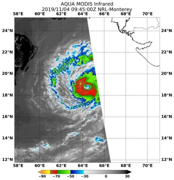
On Nov. 4 at 4:45 a.m. EDT (0945 UTC the Moderate Imaging Spectroradiometer or MODIS instrument that flies aboard NASA’s Aqua satellite used infrared light to analyze the strength of the storms within the tropical cyclone. NASA researches these storms to determine how they rapidly intensify, develop and behave.
Tropical cyclones are made of up hundreds of thunderstorms, and infrared data can show where the strongest storms are located. They can do that because infrared data provides temperature information, and the strongest thunderstorms that reach highest into the atmosphere have the coldest cloud top temperatures.
Read more at NASA / Goddard Space Flight Center
Image: On Nov. 4 at 4:45 a.m. EDT (0945 UTC) the MODIS instrument that flies aboard NASA’s Aqua satellite showed areas (in red) around Maha’s center where cloud top temperatures were as cold as minus 80 degrees Fahrenheit (minus 62.2 Celsius). Credit: NASA/NRL


