
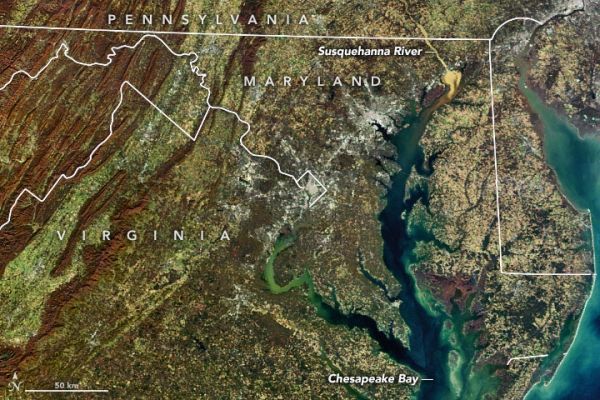
Satellite imagery captures large sediment influx to Chesapeake Bay due to heavy rains and flooding in Pennsylvania.
On Halloween 2019, a series of strong thunderstorms unleashed downpours and flooding in central Pennsylvania. In the days following, the rainwater runoff picked up sediment from farmland in the region and carried it into the Susquehanna River, past the Conowingo Dam, and into the Upper Chesapeake Bay. On November 6, 2019, the Moderate Resolution Imaging Spectroradiometer (MODIS) on NASA’s Terra satellite acquired this natural-color image of the sediment-rich river water flowing into the Bay.
Not far from where the Susquehanna River enters the Bay, the waters wash over an expanse of underwater grasses on the Susquehanna Flats. The flats are prime habitat for birds, fish, and crabs, and the health of the grasses is an indicator of water quality in that part of Chesapeake Bay.
Continue reading at NASA Earth Observatory
Image via NASA Earth Observatory


