
NASA’s Terra satellite captured an image of developing Tropical Storm Raymond in the Eastern Pacific Ocean.
NASA’s Terra satellite captured an image of developing Tropical Storm Raymond in the Eastern Pacific Ocean.
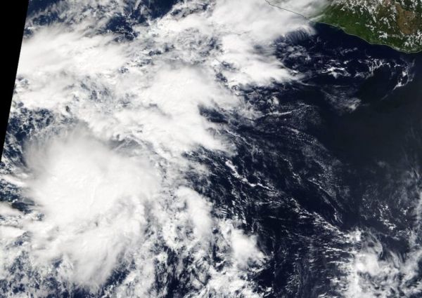
On Nov. 14, the MODIS or Moderate Resolution Imaging Spectroradiometer instrument that flies aboard NASA’s Terra satellite provided a visible image of then Tropical Depression 20 (TD20) in the Eastern Pacific. The image showed that the storm was being affected by outside winds, pushing much of the clouds and showers to the east of the center. Despite that wind shear, TD20 continued organizing and became Tropical Storm Raymond on Nov. 15.
In general, wind shear is a measure of how the speed and direction of winds change with altitude. Tropical cyclones are like rotating cylinders of winds. Each level needs to be stacked on top each other vertically in order for the storm to maintain strength or intensify. Wind shear occurs when winds at different levels of the atmosphere push against the rotating cylinder of winds, weakening the rotation by pushing it apart at different levels.
Read more at NASA / Goddard Space Flight Center
Image: On Nov. 14, the MODIS instrument that flies aboard NASA’s Terra satellite provided a visible image of then Tropical Depression 20 in the Eastern Pacific. TD20 continued organizing and became Tropical Storm Raymond on Nov. 15. Credit: NASA Worldview


