
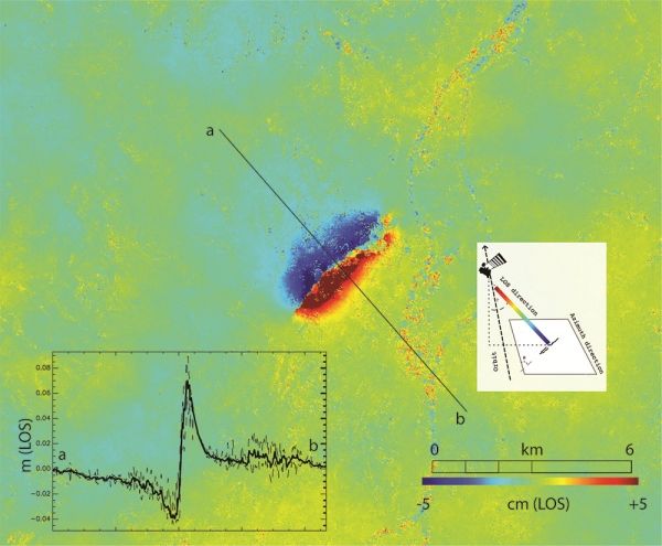
This week, southeast France was hit by a magnitude 5 earthquake with tremors felt between Lyon and Montélimar. The Copernicus Sentinel-1 radar mission has been used to map the way the ground shifted as a result of the quake.
Earthquakes are unusual in this part of France, but on 11 November at noon (local time) part of the Auvergne-Rhône-Alpes region was rocked by a quake leading to people having to be evacuated and buildings damaged.
Scientists are turning to satellite-based radar observations to help understand the nature of the seismic fault and map its location.
By combining imagery acquired before and after a quake, changes on the ground that occurred between the two acquisition dates lead to rainbow-coloured interference patterns in the combined image, known as an ‘interferogram’, which allows scientists to quantify ground movement.
An acquisition by Copernicus Sentinel-1 was made on 12 November, one day after the event, and was ready to process on ESA’s Geohazards Exploitation Platform (GEP), which is a cloud-based processing environment with on-demand terrain motion mapping services.
Continue reading at European Space Agency
Image via European Space Agency


