
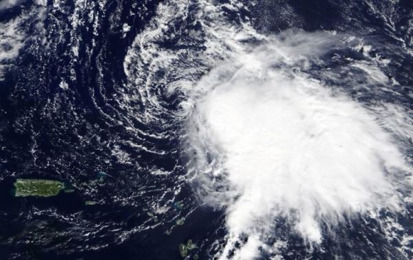
NASA’s Terra satellite captured a visible image of Tropical Storm Sebastien that showed wind shear had pushed the bulk of its clouds and showers to the southeast of the center.
NASA’s Terra satellite captured a visible image of Tropical Storm Sebastien that showed wind shear had pushed the bulk of its clouds and showers to the southeast of the center.
In general, wind shear is a measure of how the speed and direction of winds change with altitude. Tropical cyclones are like rotating cylinders of winds. Each level needs to be stacked on top each other vertically in order for the storm to maintain strength or intensify. Wind shear occurs when winds at different levels of the atmosphere push against the rotating cylinder of winds, weakening the rotation by pushing it apart at different levels.
On Nov. 20, the Moderate Resolution Imaging Spectroradiometer or MODIS instrument that flies aboard NASA’s Terra satellite provided a visible image of Tropical Storm Sebastien. The MODIS image showed the center of circulation appeared to be surrounded by wispy clouds, and that northwesterly wind shear had pushed the bulk of Sebastien’s clouds and showers southeast of the center. In addition, the low-level center of circulation was exposed to outside winds.
Read more at NASA / Goddard Space Flight Center
Image: On Nov. 20, 2019, the MODIS instrument that flies aboard NASA’s Terra satellite provided a visible image of Tropical Storm Sebastien in the Atlantic Ocean. Puerto Rico can be seen to the left of the storm. Credit: NASA Worldview


