
NASA’s Terra satellite captured an image of Tropical Storm Fung-Wong as it continued weakening in the Northwestern Pacific Ocean.
NASA’s Terra satellite captured an image of Tropical Storm Fung-Wong as it continued weakening in the Northwestern Pacific Ocean.
In the Philippines, tropical cyclone warning Signal #1 was in effect for the Luzon province of Batanes on Nov. 21 as the storm tracks northward and away from the Philippines. The storm is expected to stay to the east of Taiwan and affect the northeastern part of the country.
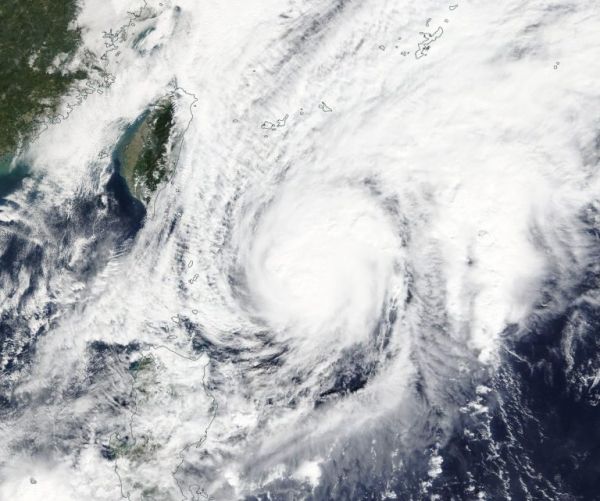
On Nov. 21, the Moderate Resolution Imaging Spectroradiometer or MODIS instrument that flies aboard NASA’s Terra satellite provided a visible image of Fung-Wong. The MODIS image showed strong thunderstorms around the low-level center of circulation. The Joint Typhoon Warning Center noted, “A microwave image that depicts tight shallow banding wrapping into a defined low level circulation center with deep convection (strong rising air that forms the clouds and storms that make up a tropical cyclone) sheared to the northeast due to strong southwesterly flow aloft.”
Read more at NASA / Goddard Space Flight Center
Image: On Nov. 20, 2019, the MODIS instrument that flies aboard NASA’s Terra satellite provided a visible image of Tropical Storm Fung-Wong near Taiwan. Credit: NASA Worldview


