
According to a new study, emergency responders could cut costs and save time by using near-real-time satellite data along with other decision-making tools after a flooding disaster.
According to a new study, emergency responders could cut costs and save time by using near-real-time satellite data along with other decision-making tools after a flooding disaster.
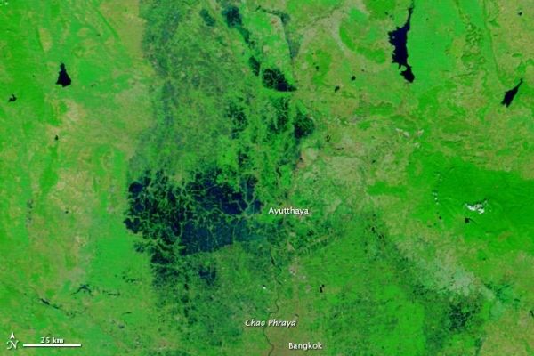
In the first NASA study to calculate the value of using satellite data in disaster scenarios, researchers at NASA's Goddard Space Flight Center in Greenbelt, Maryland, calculated the time that could have been saved if ambulance drivers and other emergency responders had near-real-time information about flooded roads, using the 2011 Southeast Asian floods as a case study. Ready access to this information could have saved an average of nine minutes per emergency response and potential millions of dollars, they said.
The study is a first step in developing a model to deploy in future disasters, according to the researchers.
Read more at: NASA/Goddard Space Flight Center
Banner Image: In 2011, heavy monsoon rains and La Niña conditions across Southeast Asia's Mekong River basin inundated and destroyed millions of acres of crops, displacing millions of people and killing hundreds. The floodwaters are visible as a solid blue triangle on the left side of this MODIS image from November 1, 2011. Credit: LANCE/EOSDIS MODIS Rapid Response Team, NASA's Goddard Space Flight Center (Photo Credit: LANCE/EOSDIS MODIS Rapid Response Team, NASA's Goddard Space Flight Center)


