
For the first time, scientists have developed a method to monitor carbon emissions from tropical forests with an unprecedented level of detail.
For the first time, scientists have developed a method to monitor carbon emissions from tropical forests with an unprecedented level of detail. The approach will provide the basis for developing a rapid and cost-effective operational carbon monitoring system, making it possible to quantify the economic cost of deforestation as forests are converted from carbon sinks to sources. The study was published in Scientific Reports on Nov. 28, 2019.
Researchers at the Arizona State University Center for Global Discovery and Conservation Science (GDCS) worked with satellite imagery from Planet Inc., an Earth-imaging company based in San Francisco, to develop maps of carbon stocks and emissions for Peru by combining millions of hectares of airborne laser measurements of canopy height with thousands of high resolution Planet Dove satellite images.
“We combined advanced remote sensing data and machine learning algorithms to estimate aboveground carbon stocks and emissions throughout the highly diverse ecosystems of Peru," said Ovidiu Csillik, lead author of the study. "Our approach will serve as a transformative tool to quantify and monitor climate change mitigation services provided by tropical forests.”
Using this technology, the researchers were able to estimate a total of 6.9 billion metric tons of carbon stored aboveground in Peru’s diverse ecosystems, of which only 2.9 billion tons are found in protected areas. However, they also found that between 2012 and 2017, 80 million metric tons of new carbon were sequestered aboveground in forests, but another 96 million tons were emitted via logging, deforestation and other factors. This resulted in a net loss of forest carbon in the five-year study period.
Read more at Arizona State University, Center for Global Discovery and Conservation Science
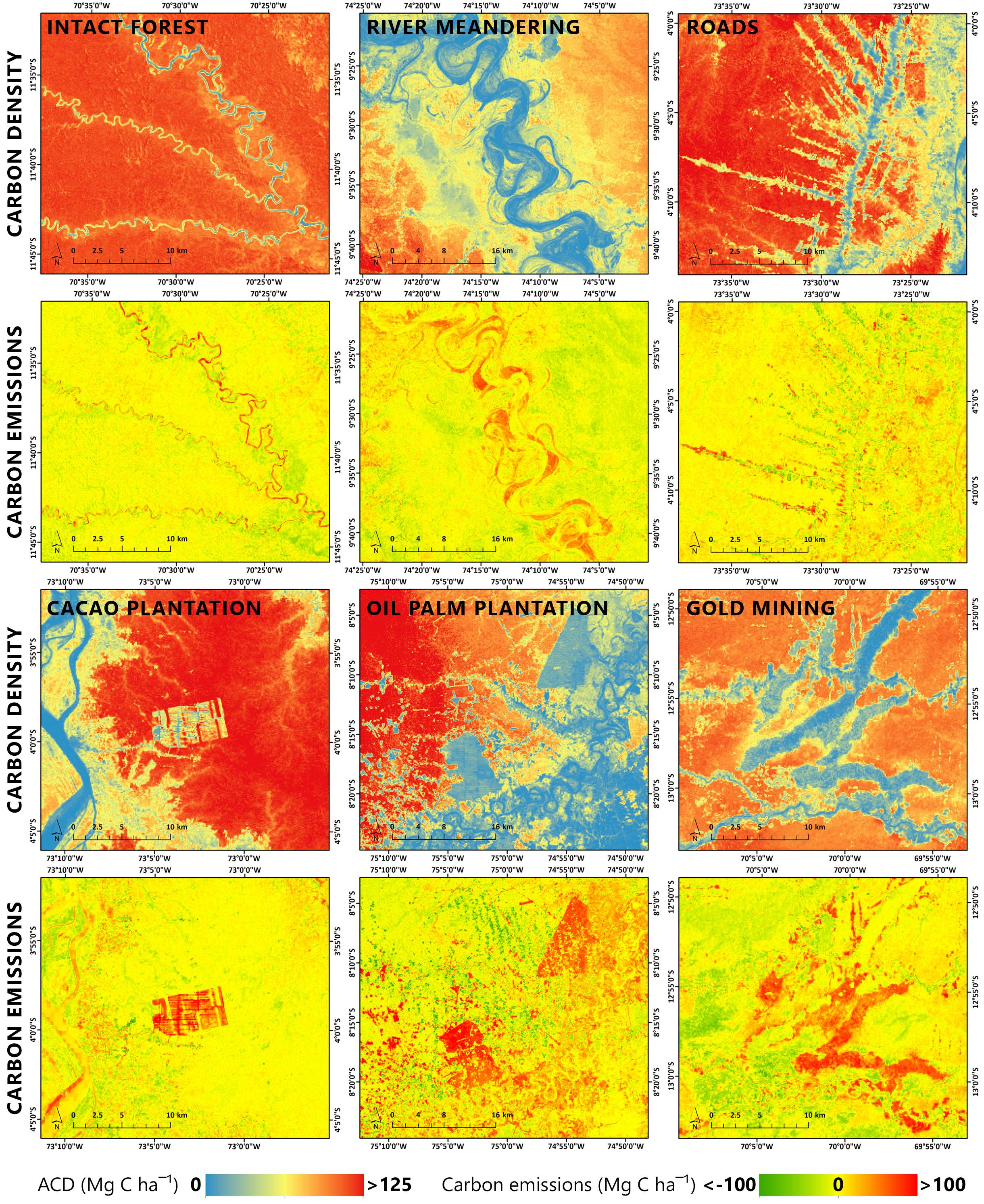
Image: Examples of changes over time in aboveground carbon density estimates between 2012 and 2017 in Peru. Various patterns are shown, from intact forests and river meandering, to human-dominated sources of carbon emissions, represented by deforestation along the Iquitos-Nauta road in Loreto, aggressive cocoa plantation expansion near Iquitos, oil palm plantations near Pucallpa, Ucayali, and expansion of gold mining activities in Madre de Dios. (Credit: Arizona State University, Center for Global Discovery and Conservation Science)


