
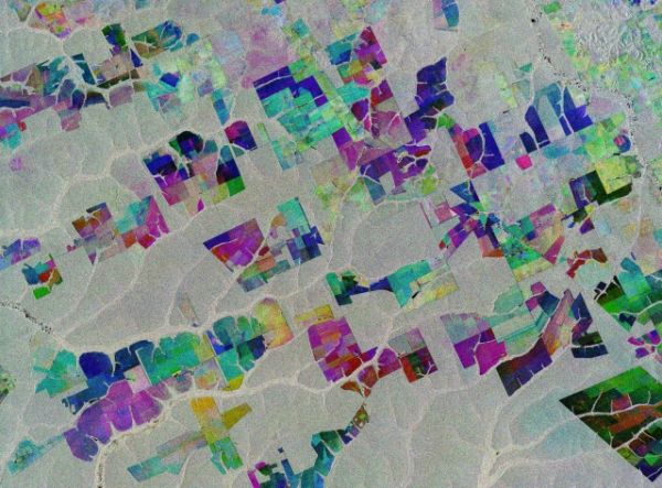
The Copernicus Sentinel-1 mission takes us over part of the Brazilian state of Mato Grosso deep in the Amazon interior.
This image combines three separate radar images from the Copernicus Sentinel-1 mission taken about two years apart to show change in crops and land cover over time.
Unlike images from satellites carrying optical or ‘camera-like’ instruments, images acquired with imaging radar are interpreted by studying the intensity of the backscatter radar signal, which is related to the roughness of the ground.
Here, the first image, from 2 May 2015, is picked out in blue; the second, from 16 March 2017, picks out changes in green; and the third from 18 March 2019 in red; areas in grey depict little or no change between 2015 and 2019.
Ironically, Mato Grosso means ‘great woods’, but, as these coloured rectangular shapes portray, much of the tropical forest has been cut down and given over to farming. While this image only shows a small area, Mato Grosso is one of Brazil’s top cattle-producing and crop-producing states, with the main crops including corn, soya and wheat.
Continue reading at European Space Agency
Image via European Space Agency


