
Scientist discusses how NASA data advances crop science.
Dr. Damien Sulla-Menashe is a remote sensing scientist at Indigo Ag. Here is what Damien shared with us about the work he presented Tuesday at #AGU19:
Providing Growers with Real-Time Crop Health Information Using NASA’s Harmonized Landsat Sentinel-2 Product
Why is the Harmonized Landsat Sentinel-2 (HLS) Product crucial to your work?
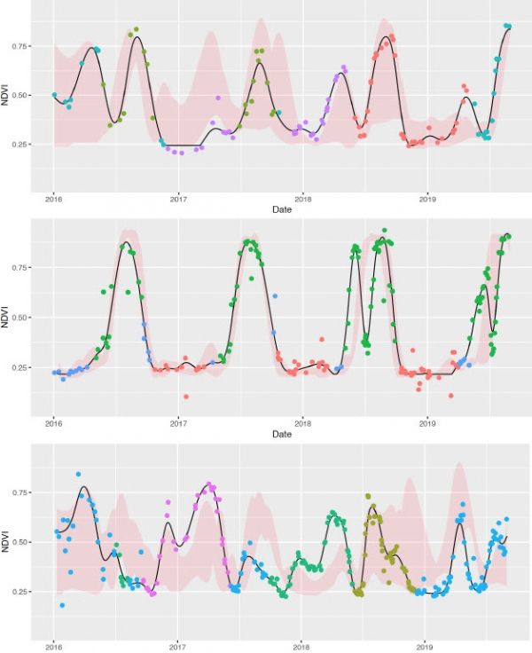
The HLS product is a high quality Earth observation dataset that follows the legacy of MODIS to provide a new standard in Level 3 processing of medium resolution satellite imagery. By bringing both NASA/USGS Landsat 8 and Sentinel-2 sensors together at a 30-m spatial resolution, we see a cloud-free observation over a single location every 3-5 days in many places.
At IndigoAg we have a mission to make growers more money and move the farming industry down a more sustainable path. This year Indigo announced the Terraton Initiative with the long-term objective to draw down one trillion tons of CO2 from the atmosphere into agricultural soils. To do this we will be promoting regenerative agricultural practices along with providing real-time information and agronomic support to farmers during the growing season.
Continue reading at NASA Landsat Science
Image via NASA Landsat Science


