
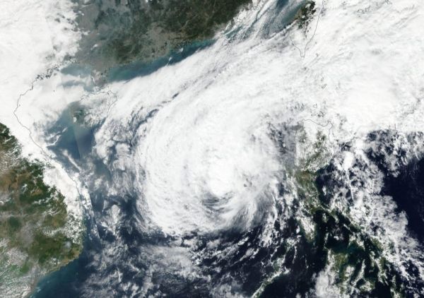
NASA-NOAA’s Suomi NPP satellite provided a visible image of Phanfone as it continued moving through the South China Sea.
NASA-NOAA’s Suomi NPP satellite provided a visible image of Phanfone as it continued moving through the South China Sea. Visible imagery showed that the storm was less organized and elongated as the storm weakened from a typhoon to a tropical storm.
Satellite imagery gives forecasters a look at the structure and strength of tropical cyclones. Visible imagery helps forecasters understand if a storm is organizing or weakening. If a storm appears more circular in nature it is an indication the storm is consolidating and strengthening. If a storm appears more elongated or asymmetrical, it is a sign that the storm is weakening.
In the visible image captured by Suomi NPP’s Visible Infrared Imaging Radiometer Suite (VIIRS) instrument, Phanfone appeared more asymmetrical.
Read more at NASA / Goddard Space Flight Center
Image: NASA-NOAA’s Suomi NPP satellite provided forecasters with a visible image of a weaker and more asymmetrical Tropical Storm Phanfone on Dec. 27 as it continued moving through the South China Sea. Credit: NASA Worldview, Earth Observing System Data and Information System (EOSDIS)


