
NASA’s Terra satellite passed over the Southern Pacific Ocean on Dec. 30 and found that Tropical Storm Sarai continued to move further away from Fiji and toward Tonga.
NASA’s Terra satellite passed over the Southern Pacific Ocean on Dec. 30 and found that Tropical Storm Sarai continued to move further away from Fiji and toward Tonga.
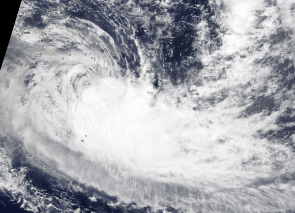
On Dec. 30, 2019, the Moderate Resolution Imaging Spectroradiometer or MODIS instrument that flies aboard NASA’s Terra satellite provided a visible image of Sarai that showed the storm had flaring convection andthe strongest thunderstorms were around the low-level center. The storm also appeared elongated indicating it was weakening.
On Dec. 30 at 10 a.m. EST (1500 UTC), the Joint Typhoon Warning Center noted that Tropical Cyclone Sarai was located near latitude 22.1 degrees south and longitude 176.4 degrees west, about 403 nautical miles west-southwest of Niue. Maximum sustained winds were 45 knots (52 mph) and weakening.
Read more NASA / Goddard Space Flight Center
Image: On Dec. 30, 2019, the MODIS instrument that flies aboard NASA’s Terra satellite provided a visible image of Tropical Storm Sarai moving away from Fiji. Credit: NASA Worldview


