
First detected with sound, new study monitors zooplankton movement with light
First detected with sound, new study monitors zooplankton movement with light
During WWII, naval oceanographers discovered a reflective layer that rose and fell across their sonar screens once each day. Further research revealed that it comprised swarms of fish and tiny sea creatures called zooplankton migrating toward the ocean surface as the sun set to feed under cover of darkness, then swimming back to the inky depths at dawn to escape their own predators during daylight hours.
Initially valued as a way for submarines to hide their movements, this daily vertical migration is now known to play a major role in the global carbon cycle, as the consumption of surface algae by migrating zooplankton carries carbon to the deep sea, thereby reducing carbon-dioxide levels in the surface ocean and atmosphere. But the exact amount of carbon exported to the deep sea via this "biological pump” has remained difficult to quantify on a global basis, based as it is on intermittent measurements from single ships atop a vast ocean.
A study published in the December 12th issue of Nature reports on the use of satellite-borne lidar to map the daily vertical migration of zooplankton across the world’s seas over the course of a decade. Lidar is the laser equivalent of sonar, using pulses of light rather than sound to image objects in the air and water.
Read more at Virginia Institute of Marine Science
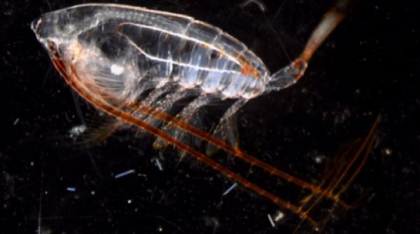
Image: Vertical Migrator The copepod Neocalanus cristatus, a vertical migrator. © Karen Stamieszkin/VIMS/EXPORTS.


