
NASA’s Aqua satellite provided a near visible image and analyzed the cloud top temperatures in Tropical Cyclone Blake, located along the northern coast of Western Australia.
NASA’s Aqua satellite provided a near visible image and analyzed the cloud top temperatures in Tropical Cyclone Blake, located along the northern coast of Western Australia. Tropical Cyclone Blake is just north of Broome, a coastal town in the Kimberley region of Western Australia.
On January 6, the Australian Bureau of Meteorology posted warnings and watches for Blake. The Warning zone stretches from Cockatoo Island to De Grey. The Watch zone extends from De Grey to Whim Creek, including Port Hedland and extending inland to include Marble Bar and Nullagine.
In addition, there are several community alerts in effect. A Yellow alert is in effect for residents in or near communities from Cockatoo Island to Bidyadanga, including Bidyadanga and Broome but not including Derby, need to take action and get ready to shelter from a cyclone. A Blue alert is in effect for residents in or near communities from Bidyadanga to De Grey, need to prepare for cyclonic weather.
Read more at NASA / Goddard Space Flight Center
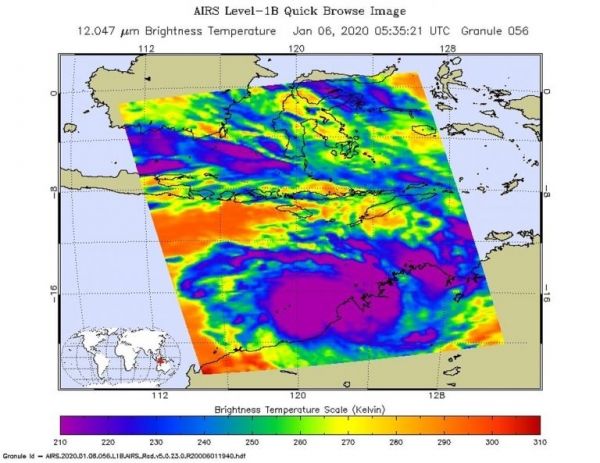
Image: On Jan. 6 at 12:35 a.m. EST (0535 UTC/1:35 p.m. AWST) NASA’s Aqua satellite analyzed Tropical Cyclone Blake’s cloud top temperatures using the AIRS instrument. AIRS showed the strongest storms contained cloud top temperatures as cold as or colder than 210 Kelvin (purple) minus 81 degrees Fahrenheit (minus 63.1 degrees Celsius) around the center. Credit: NASA JPL/Heidar Thrastarson


