
Copernicus satellites monitor continued bushfires ravaging the continent.
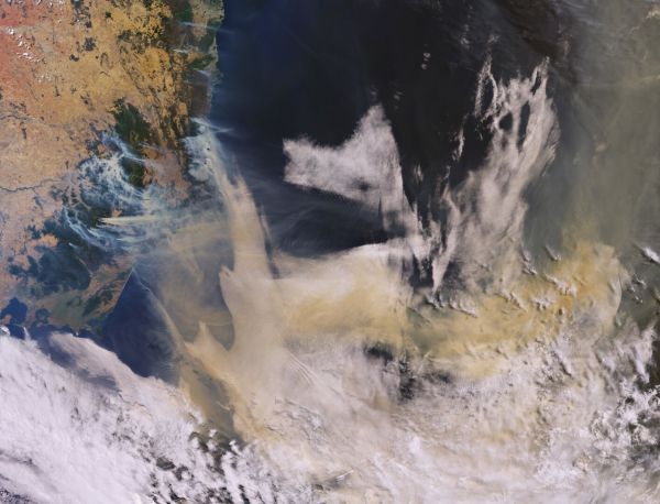
Ferocious bushfires have been sweeping across Australia since September, fuelled by record-breaking temperatures, drought and wind. The country has always experienced fires, but this season has been horrific. A staggering 10 million hectares of land have been burned, at least 24 people have been killed and it has been reported that almost half a billion animals have perished.
Photographs and film footage have without doubt left the world shocked, but the view from space shows the scale of what Australians are having to deal with. New South Wales has been worst hit. The Copernicus Sentinel-3 image above shows smoke pouring from numerous fires in the state on 3 January.
While this image was captured by the mission’s ocean and land colour instrument, which offers camera-like images, the mission’s sea and land surface temperature radiometer instrument can record fire hotspots. This instrument works like a thermometer in the sky, measuring thermal infrared radiation to take the temperature of Earth’s land surfaces.
The instrument’s two dedicated fire channels are used to compile the World Fire Atlas.
Continue reading at European Space Agency
Image via European Space Agency


