
Scientists use satellite data to monitor NO2 and ozone levels around oil & gas production sites.
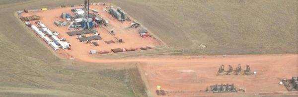
Oil and gas production has doubled in some parts of the United States in the last two years, and scientists can use satellites to see impacts of that trend: a significant increase in the release of the lung-irritating air pollutant nitrogen dioxide, for example, and a more-than-doubling of the amount of gas flared into the atmosphere.
“We see the industry’s growing impact from space,” said CIRES scientist Barbara Dix, lead author of the new assessment published in the AGU journal Geophysical Research Letters. “We really are at the point where we can use satellite data to give feedback to companies and regulators, and see if they are successful in regulating emissions.”
Dix and a team of US and Dutch researchers set out to see if a suite of satellite-based instruments could help scientists understand more about nitrogen oxides pollution (including nitrogen dioxide) coming from engines in U.S. oil and gas fields. Combustion engines produce nitrogen oxides, which is a respiratory irritant and can lead to the formation of other types of harmful air pollutants, such as ground-level ozone.
Continue reading at Cooperative Institute for Research in Environmental Sciences
Image via Cooperative Institute for Research in Environmental Sciences


