
Tropical Cyclone Claudia was dissipating in the Southern Indian Ocean when NASA’s Terra satellite captured a visible image of storm as it flew overhead in its orbit around the Earth.
Tropical Cyclone Claudia was dissipating in the Southern Indian Ocean when NASA’s Terra satellite captured a visible image of storm as it flew overhead in its orbit around the Earth.
On Jan. 15 at 4 p.m. EST (2100 UTC) the Joint Typhoon Warning Center (JTWC) noted in their final warning that Tropical Cyclone Claudia’s maximum sustained winds were down to 35 knots (40 mph/65 kph). Claudia was far from land, near latitude 21.4 degrees south and longitude 104.8 degrees east, about 521 nautical miles west of Learmonth, Australia.
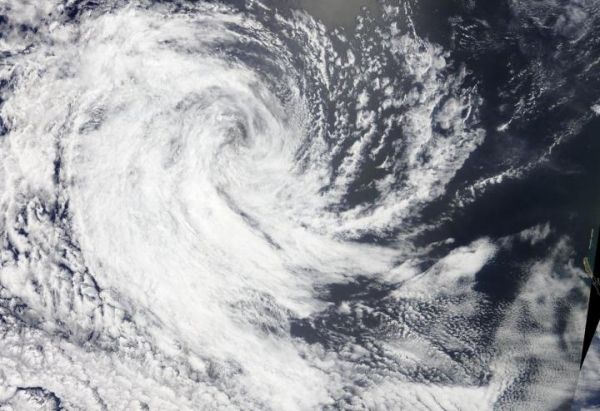
On Jan. 16, 2020, the Moderate Resolution Imaging Spectroradiometer or MODIS instrument that flies aboard NASA’s Terra satellite provided a visible image of Claudia that showed the storm was dissipating. Strong northeasterly wind shear had pushed the bulk of clouds to the southwest of the center of circulation. The center appeared exposed and surrounded by a wispy circle of clouds in the Terra satellite image.
Read more at NASA/Goddard Space Flight Center
Image: On Jan. 16, 2020, the MODIS instrument that flies aboard NASA's Terra satellite provided a visible image of Tropical Cyclone Claudia as it was dissipating in the Southern Indian Ocean. (Credit: NASA Worldview)


