
Tropical Cyclone 09S formed on Jan. 22 in the Southern Indian Ocean despite being affected by vertical wind shear, and one day later wind shear caused its demise.
Tropical Cyclone 09S formed on Jan. 22 in the Southern Indian Ocean despite being affected by vertical wind shear, and one day later wind shear caused its demise. The end of 09S was caught by NASA’s Aqua satellite.
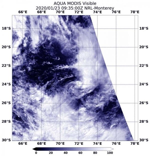
On Jan. 23 at 4:35 a.m. EST (0935 UTC), the Moderate Imaging Spectroradiometer or MODIS instrument that flies aboard NASA’s Aqua satellite provided a visible image of 09S. Forecasters at the Joint Typhoon Warning Center (JTWC) noted that satellite imagery shows “The system has severely degraded as the central convection collapsed and sheared eastward, exposing a ragged and weak low level circulation.”
In general, wind shear is a measure of how the speed and direction of winds change with altitude. Tropical cyclones are like rotating cylinders of winds. Each level needs to be stacked on top each other vertically in order for the storm to maintain strength or intensify. Wind shear occurs when winds at different levels of the atmosphere push against the rotating cylinder of winds, weakening the rotation by pushing it apart at different levels. Wind shear pushing from the west against Tropical Cyclone 09S is moving the bulk of clouds and showers east of the center.
Read more at NASA/Goddard Space Flight Center
Image: On Jan. 23, 2020 at 4:35 a.m., EST (0935 UTC) the MODIS instrument that flies aboard NASA's Aqua satellite provided a visible image of Tropical Storm 09S in the Southern Indian Ocean. (Credit: NASA Worldview)


